


Partners: FORD, TAI, TCELL, TB, KATAM, ROBONIK, BUYUTECH , AVU, CC
The drone will record all the terrain and trees. Orientation will be completely or partially independent from GPS support due to poor satellite reception under dense tree canopy. In the demo, the drone flies below the tree canopies from position A to position B and makes video recordings of the surrounding environment. Video and sensor data is stored on the device for later post-flight analysis. As an intermediate solution the data acquisition was during the project performed by a hand held drone system.
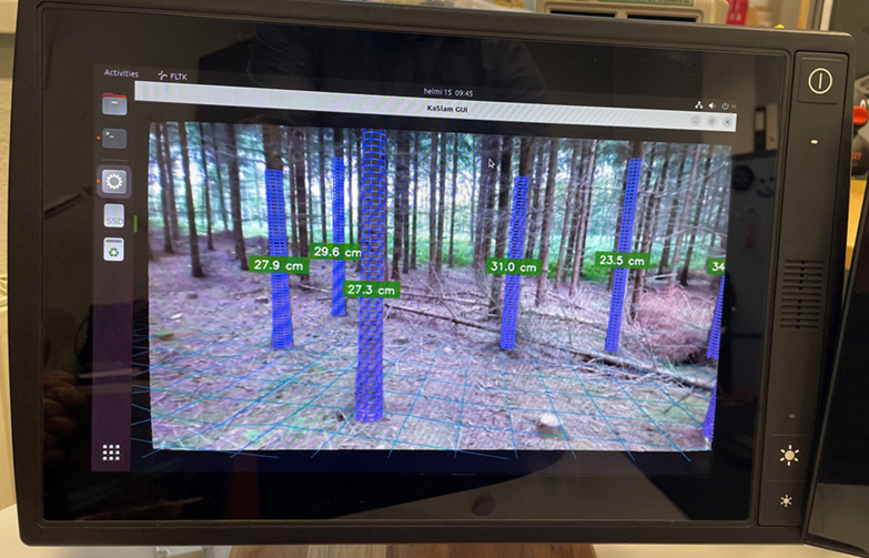
For post-flight analysis, the HMI edge computer performs AI-based processing of the drone-recorded video feed, and visualizes the terrain and tree diameters on the display, made available to the view of a forestry harvester vehicle operator.